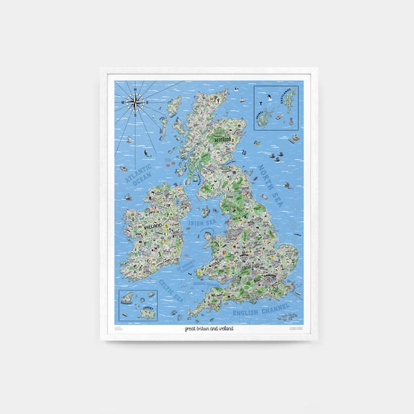


Hand Drawn Map of Great Britain & Ireland by Jenni Sparks.
24" x 30" / 60.1cm x 76.2cm.
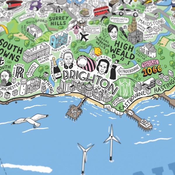
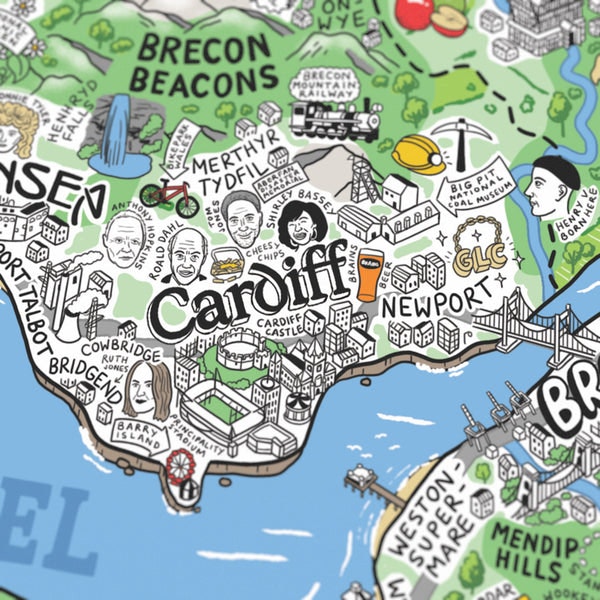
For the first time, illustrator Jenni Sparks has mapped out England, Scotland, Wales and Ireland with her Hand Drawn Map of Great Britain & Ireland. Distilling the quirks and culture of Britain and Ireland with playful graphics, this map takes an in-depth tour of its many towns and cities. It dives into historic sites, like the Long Man of Wilmington, and legendary local landmarks, like Manchester’s Haçienda, handily organising areas around motorway and ferry routes.
The map derives from countless hours of research, trips, and tips from locals from across the Great Britain & Ireland. Compiling sports team rivalries, foodie destinations and strange folklore, Jenni has turned her findings into a stunning art print. Her artwork creates the definitive companion guide for a journey across Great Britain & Ireland, tapping into the personality behind its many faces and places with effortless humour.
Meticulously detailed:
Brought to life through Jenni’s elaborate drawing process, this map blends hundreds of isometric illustrations with 2D graphics to capture the details of Great Britain & Ireland. It also creatively represents each area with a unique typographic style.
Staycation inspiration;
More than solely a design must-have, Jenni’s new illustrated map has been drawn around motorway and ferry routes to help inspire the travel route for your next holiday in the Great Britain & Ireland.
If you know, you know:
From century-old institutions to Gloucester Services, each point of the map varies enjoyably in tone. Local in-jokes and popular culture icons – look out for Cilla Black and Rob (McElhenney) & Ryan (Reynolds) of Wrexham – can be found hidden within the illustrations.
Areas Covered:
Jenni Sparks’ Hand Drawn Map of Great Britain & Ireland covers the UK and Ireland, featuring Shetlands, Orkney, Guernsey and Jersey. In the process, the map illustrates beaches, wildlife areas, heritage sites and scuba diving spots.

The product will be shipped to you from: Evermade in Brighton, UK.
Premium international shipping for $19.49
Estimated arrival in 3 to 5 working days
14-day returns
On items eligible for returns, you have 14 days from delivery to submit a return request. Learn more.
Ordering between the UK and the EU?
There are no hidden fees or additional charges once you’ve paid for your order. Enjoy hassle-free cross-border shopping. Learn more